Wine, Whales and Wheelly Steep Hills (or, the Antill Mob road trip part 3)

Wine, Whales and Wheelly Steep Hills (or, the Antill Mob road trip part 3)

I said I would update from Christchurch, and here I am actually updating from Christchurch. 368 days after leaving the UK, in less than 24 hours, I will be boarding the plane to head back home for a bit. How long? Who knows! Where next? Your guess is as good as mine. I predict two more blog updates after this one – one to round off the Antill Mob road trip (it will be a long one, it has to cover Tekapo/Pukaki/Twizel, Wanaka, Te Anau/Milford Sound, Queenstown/Arrowtown, Oamaru and Christchurch. I really should have split this one off later, but it seemed like a good place to stop) and one final post to round things off. Judging by my previous posting schedule, you should get those by the start of May…

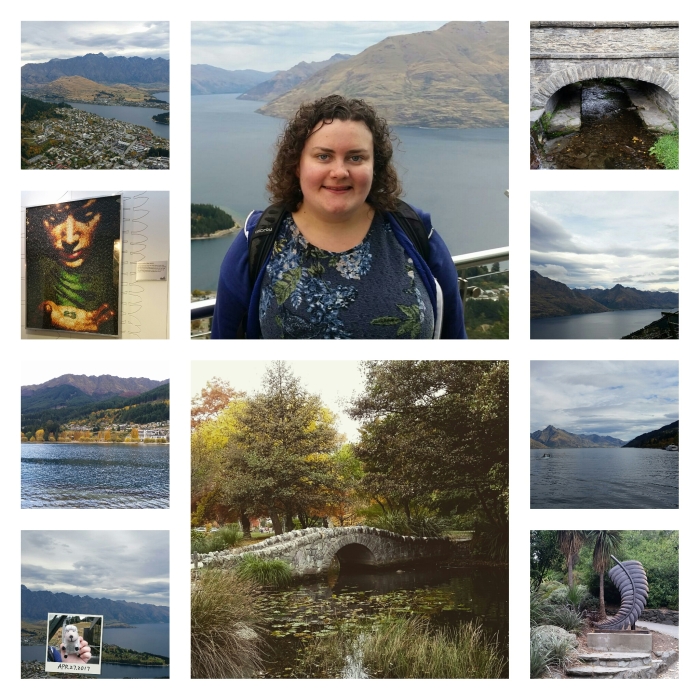
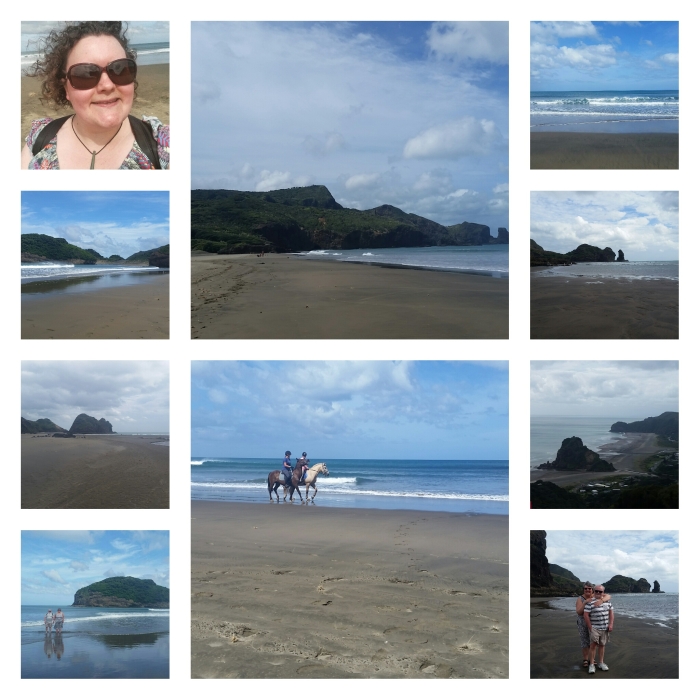
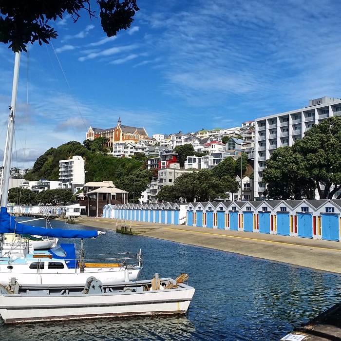
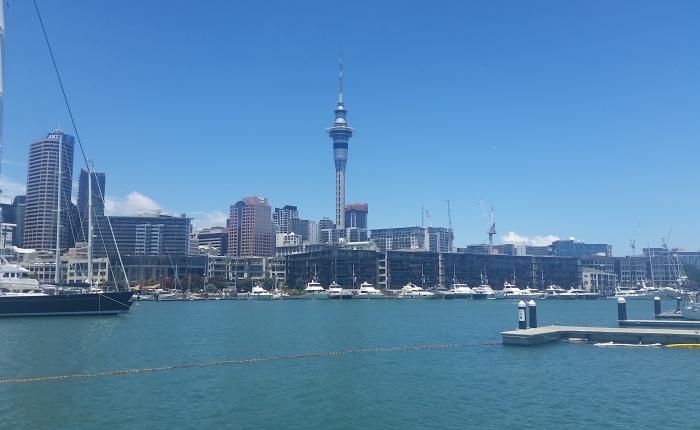
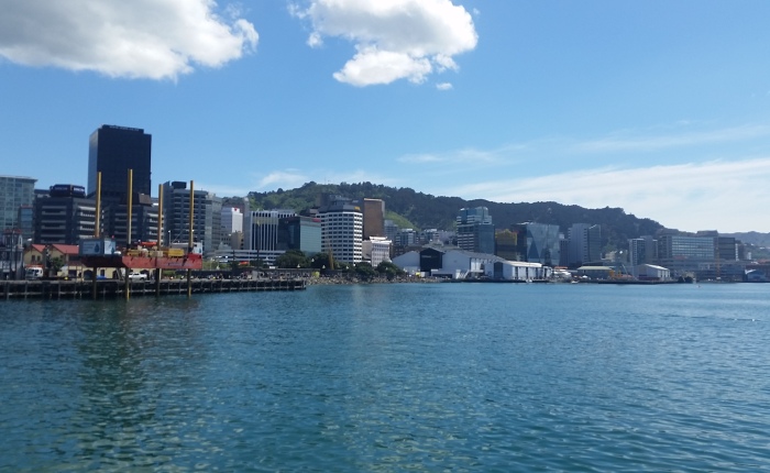
Where did we leave off? Ah, yes, we left Wellington to make our way to the South Island. In the run up to our trip, I had been quite concerned about the ferry. Living in Wellington, I know how windy it can get on the Cook Strait, and I’ve heard a lot of horror stories about the crossing in high winds or rough seas. Not being the best traveller on a good day, I was expecting it to be a long and unpleasant three hours. What we got instead was 3 hours of brilliant sunshine, no wind and barely a ripple in the waters. You couldn’t have wished for a smoother journey. Here are some of the pictures I took on the way:

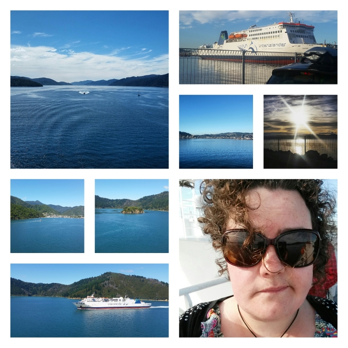
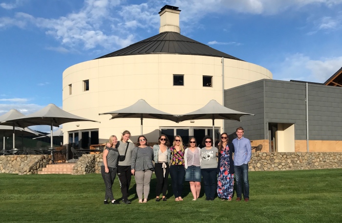
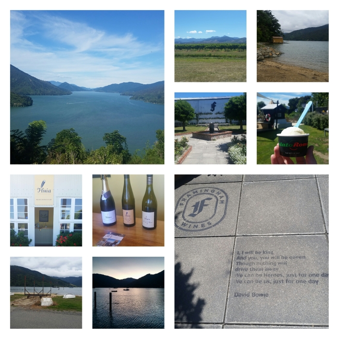
Arriving in Picton at 12.30, we made the logical next step of driving straight to Blenheim and doing some wine tasting (the boring, proper way, as we were driving. No drinking all the samples for us). The reason we did this straight away was not because 10 days of travelling together had driven us all to alcoholism, but because it was a) the nicest weather forecast for our few days in Marlborough; b) the day before Marlborough Fest, so much quieter than the following day would have been; and c) we were staying halfway between Havelock and Picton, so it made for a nice round trip to go there one way and come back the other way. Logic at work.

Deciding only to do three wineries, we did two of my favourites from last time, Huia and Framingham, and one that I hadn’t done before, Bladen (of course, I forgot to take any pictures of that one, oops). To say that both times I have been wine tasting previously, I have visited about 6 wineries and not bought any wine, this time, we visited 3 wineries and bought 3 bottles of wine. We’re on holiday, after all. It’s also a lot easier to finish a bottle when there are 3 of you instead of 1 (not being a fan of drunkenness or hangovers).

As the weather the following day was grey with showers on and off, we took the day as a well-deserved rest stop. We were in a lovely little guesthouse in Anakiwa, a little hamlet along Queen Charlotte Drive. It’s the starting point of the Queen Charlotte Track, and home to an Outward Bound school for adults to learn allsorts of outdoorsy skills… not being particularly outdoorsy, I didn’t pay much attention past “long run before breakfast”. There are probably 50 or so houses in Anakiwa, but only 12 are occupied all year round, the rest are second homes or holiday rentals. After the end of the school holidays, it was the very definition of peaceful. Just what we needed before the rest of our itinerary.

After that welcome rest, it was once again time to move on to the next destination. This time, Kaikoura. It was one of the places that I had missed off the first time I travelled around the South Island, because State Highway 1 was closed following the Kaikoura earthquake in November 2016, and it made travelling there by bus on the way to Blenheim too difficult. This time, SH1 was open, we had a car, and it was all good to go… aside from the weather. It had been raining on and off all day on the way down, and when we went to check in for our 3.30pm whale watching cruise, we found that it had been cancelled due to rough seas. Sad face. As whale watching had been Mum’s activity of choice for her 60th birthday 2 days later, this presented a slight problem. Was there a chance that we could book on one of the morning cruises for the next day? Well, we could have the 7.15 am cruise time, but only one of us could go as there was only one seat left. Ah – In that case, was it a possibility to put Mum on that cruise and refund my place? Sure, but would you like us to put you on the waiting list for tomorrow – there’s no one else on it at the moment, and if you didn’t get a spot, we can refund you in the morning? Yes, please, that sounds wonderful.

So there we were, bright and early (well, the sun was just rising), wondering if I would get a place on the cruise. As soon as we walked through the doors to check in, the manager we had spoken to yesterday waved us right over and said she had found me a spot. Perfect! The weather was clear blue skies, so it actually turned out much better than if the cruise the day before had been running. Yes, there was quite a strong swell out in the deeper waters, but I am the Queen of Travel Sickness Medication, don’t you know?! About a dozen people threw up over the 2 and a half hours, and I was NOT one of them. So there.

So was it worth the money and the early morning? Definitely! We saw 2 sperm whales, a humpback whale, a blue shark, a NZ fur seal, several different kinds of albatross and a lot of dusky dolphins. The absolute best you could wish for, really. I managed to get lots of videos that I haven’t even looked at yet, and 2 short videos of one of the sperm whales and the humpback whale’s tails. Definitely a success. As with the dophin videos from Paihia, please let me know if these have come out upside down and I will try to fix them. They seem to play ok on my tablet, but the preview looks upside down.

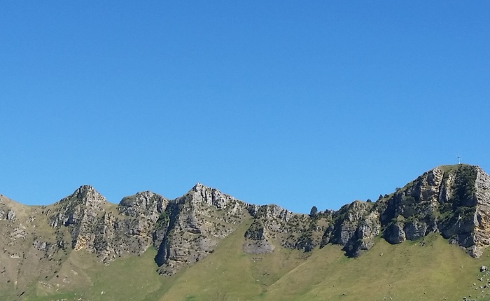
While Mum and I were whale watching, Dad was doing some sightseeing around Kaikoura. It certainly looked much better in the nice weather than it had in the rain the day before. The bottom left picture, above, was taken in the bad weather, with the top left picture taken the next day. You could actually see the hills, this time. Soon enough, it was time to move on again. This time, to Lyttelton.

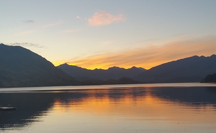
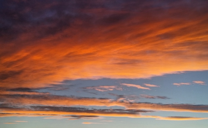
I’m using the distinction of saying we went to Lyttelton this time, as we didn’t go into Christchurch at all. Even though Lyttelton is the port for Christchurch, we used it as a base to see the Banks Peninsula, and because it was Mum’s birthday and it had a hot tub. Our AirBnB was lovely, up a steep hill with a really narrow road (think Matlock, Darley Dale or parts of Bakewell), overlooking the harbour. We enjoyed dinner out on the deck both nights, and had 2 fantastic sunsets. A perfect place to spend Mum’s birthday.

On the day itself, we drove out to Akaroa, around the Banks Peninsula. We drove there the sensible way, along the State Highway. It reminded me how flat a lot of Canterbury is, with impressive hills on one side of the road but the other side was flat fields for as far as the eye can see. Then, we got to the up and down hilly bit, which was fine, the road was wide and marked and sealed, all well and good. Driving back was another matter entirely. Dad had the bright idea to drive over to Pigeon Bay and then take the “coastal” route back to Lyttelton. Despite not showing as such on the map, this meant 24km of hilly, gravel, single track road. In fact, in a lot of places, the gravel was long gone and there were just deep tracks of dirt. Well, at least it was dry. Let’s just not mention the sheer drops down the side of the road without any sort of fence.

Dad described it as follows:

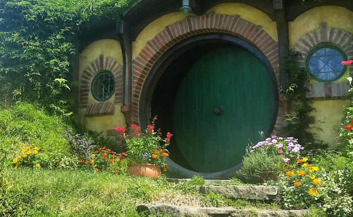
“Well, you know the bit in the Lord of the Rings, where they’re climbing the mountain and there’s avalanches? Well, it was a bit like that, only without the snow and the avalanches, but for 24 kilometres.”

Akaroa was lovely. It’s an old French settlement – the French arrived in 1840 thinking it would make a nice place for a colony, only to find that the British had beaten them to it. It still has some French road names, and likes to emphasise the link for tourism purposes, but it’s a pretty little town. It was a cruise ship day, so there were more people around than we would have liked, but we enjoyed our little outing. Until the drive home, at least.

Well, that’s it for now. I’m off to enjoy my last day in New Zealand. If I manage to type up the next instalment on the flight, I’ll post it when I get home. Otherwise, you’ll have to wait until I’ve slept off the jetlag. It seems strange not to have any more NZ plans after so long, but I have some great UK things to look forward to in the next couple of weeks. First: I’m taking myself to London for the day on Wednesday to see Julius Caesar. Because I’m the only Shakespeare nerd I know.

Think of me tomorrow, while you are enjoying the freedom of not being stuck up in the air in a tin can.

A Long-expected Blog Post

A Long-expected Blog Post

In a great surprise to exactly no one, I’ve gone from being 3 days behind in my real-life-to-blog-update delay to… 14 days behind. This post is going to cover the remaining time we spent in the North Island, then I plan to do 2 posts about the South Island… at least one of which WILL be posted before I leave the country.

So, where were we? Ah, yes, I’d arrived in Tauranga. We only really had one full day to spend in the area between travelling to different places, so we spent most of the morning and early afternoon around Mt Maunganui. Dad and I did the track around the base of the Mount (neither of us being brave or energetic enough to climb to the summit). The actual walk itself wasn’t that long, but once you’ve factored in having to stop every 50 metres or so for your father to take a picture… it took a while. We’d picked a day when the waves were out in full force, crashing on the rocks and producing some spectacular spray. I’m fairly sure that when we get home, both of us will look at our pictures from that walk and ask ourselves why we have so many bloody photos of waves!

After we finally completed our circuit of Mt Maunganui, we met back up with Mum for a wander around the local artisan market. Anyone reading this blog on a regular basis will know that I love a good market, and this one didn’t disappoint. As well as the usual locally-made jewellery, skin care, papercrafts and toys, all good markets have a selection of food stalls. Really the only reason anyone would ever go to one in the first place 😉 At a little stall called ‘Pure Bites’, I bought a Bostock pastry. If, like me, you have no idea what a Bostock is, it is a slice of brioche toasted with a frangipane topping and sliced almonds, in this case topped with whipped cream and raspberries. Basically, heaven in your mouth. I ate the whole thing and I’m not even ashamed. We rounded out our visit by ambling along Mt Maunganui beach and taking in the sunshine – not a bad day, all round.

The next morning (which was a Sunday, I believe. I have totally lost track of the days of the week.), we made our way up along the east coast of the Coromandel Peninsula to Whitianga, as we had arranged a sailing trip for Monday. We spent the day exploring Cathedral Cove and the islands around it aboard the Windborne, a gaff-rigged topsail schooner built in 1928. Captain Avon made the day entertaining for all, even if it wasn’t really windy enough to sail without the engine for very long. As well as getting to spend the day aboard this beautiful ship, it saved us the effort of parking up and walking down to Cathedral Cove on foot – as it was raining the first time we passed and brilliant sunshine on the way back, there’s no saying what the weather would have been like had we walked. Oh, and we got picked up by the Navy. As the HMNZS Manawanui was in port at Whitianga and tides were high, and Captain Avon was mates with the Captain of the Manawanui (this being New Zealand), we all got a lift in a dinghy out to the Windborne… as you do.

The Coromandel is absolutely stunning, though the weather was rather mixed for our two days up there. If/when I make it back to NZ, it’s definitely on my list of places to explore a bit more.

After driving back to Tauranga for the night, it was soon time for possibly THE most important day of my entire year in New Zealand (at least, to some people. Mainly those I told I was going to become a professional hobbit) – Hobbiton!

Full disclosure – I had fully expected to be disappointed by Hobbiton. Paying $80 for a 2-hour tour and not knowing what the weather will be like on that day leaves a lot of room to be let down. Fortunately, and likely because my expectations were fairly low, I had a wonderful time. The weather played ball, with a short shower just before our tour and another after we left, but brilliant sunshine throughout our 2-hour timeslot. Whilst it is true that you can’t go at your own pace (a couple of times I had to chivvy dad along to stop him getting mixed up with the tour group behind us), all of the stopping points are carefully planned to minimize views of the other groups. The whole area was much larger than I had expected – The WB Studio Tour in London having demonstrated how directors and camerapeople can make a small space seem enormous – and each stopping point was better than the last. I would have liked to have 10 minutes longer on the tour and 10 minutes less in the Green Dragon, but I know a lot of people find their time at the Green Dragon to be quite limited, so this could just be me.

It’s hard to pinpoint a few highlights from what was overall a fantastic experience. Happily, Dad enjoyed it as much as I did, which had been a bit of a worry. I’d intended to do Hobbiton on the way up to meeting them in Auckland, but it was a bit of a pain in the arse to sort out; in the end, I essentially told Dad that we were going to go on the way from Tauranga to Turangi and that he was coming with me (Mum not being bothered about it). As I’m sure you can imagine, we were both absolutely thrilled to discover that we were short enough to have played hobbits in both the LOTR and Hobbit trilogies (the cut-off for LOTR being 5 foot 2 and the Hobbit being 5 foot 4 or 5). Clearly by not living in New Zealand, we missed our chance. That, and I was about 9 when they filmed LOTR.

Dad has always said that a little hamlet on Chatsworth estate called Calton Lees was how he had always imagined Hobbiton before the films came out. Interestingly enough, both of our first reaction when driving through the Alexander farm to the set was to say “this looks just like Chatsworth, only without the house.” It seems he wasn’t too far off, after all.

The amount of detail put into the set is simply incredible. I had already known that Peter Jackson (Sir Pete to NZ news coverage) was a bit nitpicky when it came to the finer details, having heard the story about the leaves on the tree not being the right colour and so getting them to be painted a different shade of green, but it’s not until you go somewhere like this that you realise what it was for. Yes, it must have been incredibly annoying for the crew to keep up with ridiculous ideas like taking all the leaves and fruit off pear trees and replacing them with plums and plum tree leaves, or going around and lighting fires under the chimneys of every single hobbit hole so that there’s real smoke coming out of the chimney pots, but this little corner of a vast farm near Matamata IS Hobbiton. Well, until you try to go inside any of the doors and realise there’s nothing in there. Nowhere do you think “well, it didn’t look like this in the film” or get disappointed that something you’d looked forward to seeing was actually CGI. There are real vegetables growing in the vegetable patch (in fact, they have a pumpkin-growing competition going on), all of the plants are real (if not with the same leaves you saw for 3 seconds in the film), all of the doors open (there’s just nothing on the other side). The water mill works, and the Green Dragon is a real pub where you can have a real drink – it looks just like any country pub in the UK, only with more rounded doors and slightly lower ceilings.

As you can probably tell, I could keep going on about Hobbiton for a whole blog post by itself, but I have more stuff to write about before I can go to bed, so have some pictures instead:

I think I took about 500 pictures over 2 hours, so when I eventually come to making my NZ photo book, I’ll have a lot of fun cutting them down. I just picked 10 at random that looked good 😛

Tuesday night we stayed in Turangi, really just to see a bit of Lake Taupo and Tongariro and Ruapehu National Parks, and to break up the journey down to Wellington. It’s not a very big place, and is mostly used as a base for walkers. Unfortunately not having the time to dedicate to a proper walk, we drove along a couple of the different roads surrounding Mt Tongariro and Mt Ngauruhoe before heading down the Desert Road and towards Wellington. Just like with Mt Taranaki, the entire time we were there, the peaks were covered by clouds. This meant we couldn’t see the cone of Mt Ngauruhoe to get the full Mount Doom effect, but you could certainly see why they had used that area and neighbouring Ruapehu for the landscape of Mordor. It is unlike anywhere else in New Zealand (and the Desert Road is called the Desert Road for a reason).

For our final stop in the North Island, we arrived in good old Wellington on Wednesday afternoon. After checking in at the hotel (conveniently located opposite my first workplace in Wellington, leave as you began and all that jazz), I took Mum and Dad for a walk along the waterfront to take in some of my favourite Wellington views. Neither of them had been particularly bothered about coming to Wellington, and I had pretty much badgered them into it. Thankfully, Welly was on my side and we had three gloriously sunny and non-windy days. On Wednesday evening, we dragged my friend Ashleigh away from her work and out for dinner (why, oh why, did I only go to Monsoon Poon once?!). On Thursday morning, we dragged my flatmate Michaela away from her work and out for breakfast (not making the same mistake and going to our old favourite, Maranui). Can you see a pattern here?

As the weather was so good, and for once there was no wind, we detoured to Mt Victoria lookout to take in the views before heading back into the city centre and to Te Papa. We then spent the evening seeing my friends for farewell drinks and getting one last Pomodoro pizza. Then it was time for bed for the 9 am ferry crossing to Picton. Wellington, I will miss you. Thank you to everyone who came out to say goodbye, and everyone who made my 9 months there unforgettable. I’m very proud to be taking a piece of New Zealand home with me thanks to you 🙂

Believe it or not, the North Island part of our trip was the relaxed bit. Our South Island schedule is kind of manic (we’re currently about halfway through), so at this rate we will probably all sleep well on the plane home. It’s off to Te Anau for us tomorrow, and Milford Sound on Sunday all being well. If all else fails, I’ll update again from Christchurch next week. TTFN.

The Antill Mob (or part of it) goes on a tiki tour of New Zealand (Part 1)

The Antill Mob (or part of it) goes on a tiki tour of New Zealand (Part 1)

I really want to tell you that we’ve nicknamed our rental car “The Bulletproof Bomb” but we’re not the type to name our cars. If you don’t understand that reference (or indeed the “Ant(h)ill Mob” reference), please go and discover Wacky Races and then come back.

In case you haven’t noticed (maybe you live under a brick, have been away at sea, or don’t have social media), the Epic Antill Road Trip has begun. In fact, we’re almost a whole week into it already. With just 3 stops down out of a total of 14, we’ve already seen so much (and none of it anything that I’d already done). I am rather concerned that by about stop 12 we’ll be running on fumes, but we do have a few more restful stops up ahead of us. That and the 29-hour journey back to the UK at the end of it all (having said that, I’ve already been a geek and checked out the in-flight entertainment, and there are so many things that I’ve been meaning to watch).

Day One was a very busy day of flying to Auckland, picking up a car and driving 45 minutes to the apartment where we were staying. Exhausting, I know. Our flights serendipitously landed at around the same time (one could almost think I’d planned my flight that way…), so by the time I’d collected my bag and walked from the domestic terminal to the international terminal, it was only a short wait for my exhausted parents to pass through biosecurity and customs to the arrivals lounge. Because, you know, Middle Earth, I conveniently met them underneath this statue:

Excerpt from Dad’s travel journal:

…arrived at Auckland airport on time to be greeted by Sophie, fittingly under a massive statue of a Lord of the Rings dwarf (which I mistook for Gandalf, probably because it is so much taller than Sophie… (Daughter’s note: I’m pretty sure it’s actually from the Hobbit, but same difference).

The apartment we were staying at for the first few nights was the fantastic Maison de Rose out in the Waitākere Ranges west of Auckland. Not a bad corner of the world, all told. Up in the hills with a view over miles of native bush, it was an idyllic spot to start our holiday. 10/10 would recommend.

Day Two was beach day. We started out in the morning at Te Henga/Bethells Beach, which is accessed by a walk through sand dunes from the car park. This beach was much more impressive in person than it looked on photos (and this definitely applies to the photos I took, too), but our lasting memory of it will probably be my clever idea to take the “shortcut” route back to car park which, predictably, took about twice as long. I also discovered that volcanic (black) sand gets rather hot in the sunshine (funny, that) and that flip flops/jandals are actually pretty difficult to wear on dry sand.

Excerpt from Dad’s travel journal:

After 20 minutes trekking up, down, around and through dunes and vegetation, … and having no idea where we were in relation to either the beach or the car, it felt like the time to just recap on the checklist of advice to walkers…:

1. Wear sensible footwear – failed

2. Have a detailed map – failed

3. Plan your route – failed

4. Inform someone of your plans – failed

5. Carry water – failed

Thus reassured, we continued…

So that was fun.

After a mid-afternoon nap for the two jetlagged parties, we headed to Piha. It was practically heaving with people compared to the morning excursion (there being more than about 10 other people), but was nevertheless very impressive. We had intended to round the day off with a trip to Karekare, but we managed to miss the turn-off. Oopsie.

Day Three was crap weather day. New Zealand caught the tail end of a tropical cyclone or something, meaning pretty much the entire country had awful weather on Thursday. We actually got very lucky, as parts of Auckland flooded, the West Coast of the South Island got battered (causing us to change some of our plans for later in the trip) and, indeed, the area where we were staying got caught in flash flooding the following day due to the swollen rivers. Thankfully, we had left by then.

Not wanting to do nothing with our day, we headed out to Devonport on Auckland’s North Shore. As I had been to Auckland just before Christmas, and Mum and Dad weren’t bothered about seeing Auckland proper, we had originally planned to get the ferry to Waiheke Island. With the weather being what it was, we drove to Devonport instead. We got an ice cream out of it, so totally worth it. Despite the rain, it was still very warm out, so Mum and Dad were quite happy (as they keep telling people, “better than 3 degrees and snowing like it is at home.” I have no idea if it is 3 degrees and snowing at home, as I haven’t checked. Remind me why I’m going home, again?).

All of the sunny looking pictures above are from Day Four, which was mainly a travel day. We moved on from Auckland to Tauranga, with several stops along the way. First, we dropped in at the Arataki visitor centre, which is where all of the sunny/bush pictures above were taken. Definitely worth a quick pit stop, as the views were spectacular. Heading away from Auckland on State Highway 2, we stopped for lunch in Ngatea (a small New Zealand town, pretty much like every other inland small New Zealand town), drove through Paeroa (home of L&P, see giant bottle of pop below), and then stopped off at Karangahake Gorge. The day was rounded off nicely once we arrived at our AirBnb (about halfway between Tauranga and Mt Maunganui going the long way around) with a much-appreciated glass of red wine. Cheers!

I do still need to write about days 5-7 (it being the end of day 7 now), but, quite frankly, I’m knackered 😛 I didn’t want to get too far behind on posting, so you get this now and can read all about Mt Maunganui and the Coromandel Peninsula in a couple of days. In the meantime, I’m off to Hobbiton tomorrow. About time, too.

I think I’m quite ready for another adventure

So, here it is! My last evening in Wellington. Well, my last evening living in Wellington – we’ll be spending 2 nights here on our Epic Road Trip. Anyway, you get the point.

Since I got back from Paihia, the time has flown by. I don’t actually feel like I’m any closer to the end of my time in New Zealand, but apparently time flows in a linear fashion, and I am, in fact, quite close to leaving. *Insert imaginary gif of the Tenth Doctor just before he regenerates here* (If you are a heathen and don’t know what I’m talking about, go and Google “I don’t want to go” – now go back in time and watch Doctor Who When It Was Good).

It’s a very odd feeling to be packing up and leaving a flat, but not yet moving anywhere else. I did the exact same thing in Canada, but I don’t remember how it felt then, either. To be fair, I did finish work one day, have my birthday the next and then leave in the middle of the night, so I wasn’t really thinking about it. Also, let’s face it, I’ve never been one to spend much time reflecting on things (or even looking at my reflection), so I probably didn’t think about it at all.

On the one hand, I’m glad to have finished work, I’m looking forward to seeing a lot of New Zealand that I haven’t seen before, and it will be wonderful to see family and friends (and meet new family members) once I get home. On the other, I agreed to spend 26 days in close quarters with my parents, I will miss my friends in Wellington and living in this wonderful little city, and I do still need to find another job eventually. I’ve never really given much thought to staying in New Zealand for longer than 12 months, and I do still think I’m doing the right thing in moving on (despite what pretty much all of you lot think. I never said I was going to stay in the UK, alright?!), but it’s very bittersweet.

I’ll be honest – of the three jobs I’ve had in Wellington, all were great opportunities to learn new skills and try out jobs I’d never done before, but none were jobs I’d have wanted to do permanently (the joy of temping is that you don’t have to). I also know that, being the kind of person that I am, what job I do is less important than where I live or what else I’m doing in life. Wellington has been the perfect city for me – good coffee, great food, close to the water and easy to get around. I haven’t driven a car more than about 20 miles in one go since I left the UK, so that will be a bit of a shock to the system once I get home.

We had a very mild winter, and a beautiful summer so far. British summer has a lot to live up to (let’s face it – it won’t). The one thing about British summer that wins over New Zealand, though, is the lack of sandflies. Seriously, what is the point of sandflies? Other than to make you itch like hell and swell up like a balloon because you’re a tourist and not resistant to them. Maybe sandflies do exist somewhere in the UK, and I’m just from far enough in land/up north that I’ve not noticed. Don’t say gnats or midges, I’ve never had a problem with those. So there.

This isn’t meant to be a very long post, and it clearly isn’t one with a lot of pictures. It’s more of a status update to say I’m leaving Wellington, and I have absolutely no idea how often I’ll be updating while on the road. We’re staying in 15 places over 26 days, so I doubt I’ll be updating from every place (that’s why I have Instagram). I do fully intend to bully Dad into writing a guest post, so you have that to look forward to.

To leave off, here is one of my favourite Wellington pictures:

The One Where Sophie Saw Dolphins (aka, Bay of Islands, part 2)

The One Where Sophie Saw Dolphins (aka, Bay of Islands, part 2)

As it’s now a whole week into January, I thought I should think of a title that wasn’t based on a Christmas song. I hope you all had a very good break (if you had time off work), and that you haven’t made any totally ridiculous New Year’s resolutions that are impossible to keep (totally ridiculous resolutions that are possible are acceptable, the sillier the better).

With just over three weeks left in Wellington (when did THAT happen?!), I’ve now reached that point where I have to start thinking about packing, winding up my life here and, that job everyone loves, showing my room to prospective tenants. Can you feel my enthusiasm coming at you through the screen?

All clouds have a silver lining, however, and in my case it’s a pretty awesome silver lining. In just over three weeks, I’ll be flying up to Auckland to meet up with my parents for the first time in a year. We’re going to spend 3 and a half weeks travelling this amazing country, and I get to show them some of the places I fell in love with along the way. You’re all going to get the pleasure of seeing me and my equally-short father visiting Hobbiton (in Dad’s case, this may be under duress. I’m forcing him to go with me :P). Good times are definitely yet to come. Plus, I get a month off before I need to start thinking about jobs again. Always a plus!

It’s still far too early to start reflecting on my time in Wellington and New Zealand as a whole, so let’s get back to the point of this post. My trip to the Bay of Islands back in December.

Previously: A weekend in Auckland and a trip to Cape Reinga, the very top of the North Island.

Day 2 in Paihia was my rest day. I spent the day exploring the town, walking along the beach and just generally enjoying the sunshine. There are worse ways to spend a Wednesday. Paihia itself isn’t very big, but it’s a sweet little town in a beautiful setting. Accommodation ranges from the party hostels to motels to spa resorts. I was very glad to be there before the mad rush of the main summer season (starting from Christmas, so I was about a week ahead of it), as I imagine it changes completely when the hotels and hostels are fully booked. Fun fact about Paihia: the first ever recorded game of cricket in New Zealand was played on one of the beaches there on 20th December 1832. I’m sure someone out there, somewhere, will find this fact to be fun. Possibly.

Day 3 was boat trip day. When one is visiting the Bay of Islands, it’s only logical to take a boat trip to see, you know, islands. In this case, I had booked the trip as I wanted to see the Hole in the Rock and Cape Brett lighthouse. I had totally forgotten that it was advertised with the possibility of seeing dolphins should there be any in the vicinity. In case you hadn’t already guessed, there were dolphins in the vicinity on that day. This was a definite highlight not only of the boat trip, but of my time in New Zealand so far. Yes, it would have been nice if it hadn’t been chucking it down with rain at the time, but as the rain started just before we found the dolphins, and stopped soon after we left them, I’ll take it.

I really hope those two gifs and the video actually work. Please let me know if they don’t so that I can try to fix it!

After we left the dolphins in peace and moved on, the rain began to clear up. It was still overcast by the time we made it out to the Hole in the Rock, but by the time we stopped for lunch, it was brilliant sunshine. The Hole in the Rock is pretty much exactly what it sounds like. An island that is essentially a large, rocky cliff with a hole in the middle. We got to sail through the hole, which always sounds fun when you say it 😛

After this, it was back towards Te Rawhiti inlet, stopping for lunch at Otehei Bay on Urupukapuka Island (try saying that three times fast). By this point, the rain had cleared completely and the sun was shining. The bay was a peaceful spot, and I even went paddling in the warm water. Mainly to soothe the many, many mosquito bites on my legs, but still. Speaking of many mosquito bites, it’s been three weeks since I got back, and while the bites have gone down, the remaining red marks make it look like I’m recovering from some sort of horrible disease. Fun times.

The final stop on the tour was Russell, the township across the bay from Paihia. Russell was actually the first permanent European settlement and sea port in New Zealand. It was a rather lawless place with lots of taverns and brothels, giving it the nickname “the hellhole of the pacific”. After the Treaty of Waitangi and the subsequent establishment of the Colony of New Zealand (more on that shortly), Russell briefly became the administrative capital, before this was transferred to Auckland in 1841/42 and then Wellington in 1865. After Auckland became the capital, much of the trade moved away from Russell, leaving it a very quiet township. These days, it is a picturesque tourist spot, with a lot of the accommodation there now used as holiday homes. It really is very pretty.

On Friday, my final day in Paihia, I visited the Waitangi Treaty Grounds. For those of you that haven’t visited New Zealand, the Treaty of Waitangi was a treaty first signed on 6 February 1840 by various Māori chiefs and representatives of the British Crown. Due to some rather large discrepancies between the English and te reo Māori versions of the treaty, both parties weren’t exactly agreeing to the same terms. The English-language version granted Britain sovereignty over New Zealand, gave the Governor the right to govern the country and specified that Māori were only able to sell their land to the Crown. The te reo Māori version, however, ceded governorship to the Crown rather than sovereignty, was understood to mean that the Governor would be there to oversee pākehā (those of European descent), and that they would be giving the Crown first refusal on land purchase, after which they could sell to anyone. Yay, colonialism! To cut almost 180 years of history very short, the Waitangi Tribunal was established in 1975 to investigate claims relating to actions or omissions by the Crown. Finally, though not until 2014, the Waitangi Tribunal found that the Māori signatories did not cede sovereignty to the Crown. I don’t know about you, but I’m feeling really proud to be British right about now…

The Treaty Grounds as a tourist attraction includes a guided tour, cultural performance and access to the museum. Our tour guide was wonderful, presenting the tour as a timeline. The Grounds include the Treaty House, home of James Busby, who facilitated the signing. The house was left to ruin for many years, before being bought and restored by Lord Bledisloe in time for the centenary in 1940. There is also Te Whare Rūnanga (the House of Assembly), a carved meeting house built in the traditional style, but facing the Treaty House. This was also built for the centenary in 1940, and is where the cultural performance takes place. The Flagstaff marks the spot where the Treaty was first signed, and flies the three official flags that New Zealand has had since 1834. Finally, there is the waka house, housing the ceremonial war canoe Ngātokimatawhaorua, also launched in 1940.

I would definitely recommend Waitangi to anyone visiting the Bay of Islands. I learnt a lot on my visit, and it’s just a pretty beautiful spot. In fact, even if you aren’t planning a trip there, go over to their website and read about it. You’ll learn something new, and they will explain it much better than I can.

Well, that’s about it, really. All that was left was me travelling back to Auckland and then flying home to Wellington. Oh, yes, we had a bit of an interesting landing – coming in to land at Wellington airport, we descended towards the runway, and at about the point where you would expect the landing gear to descend, we start going up again. The captain had decided to turn around and try again from the opposite direction due to wind tunnelling on the runway. That, or he misjudged it and didn’t want to say so.

It’s beginning to look a lot like… summer? (Part 1)

It’s beginning to look a lot like… summer? (Part 1)

… and not remotely like Christmas, at least not to me. I can’t actually get my head around the fact that today is Christmas Eve. It’s summer, so my northern hemisphere brain doesn’t relate that to Christmas, plus we did Christmas in August already. It’s probably a good thing that I don’t feel particularly festive, as I’ll be spending the day by myself 😛 It’s ok, though, we left the origami Christmas Tree and the snowflake decorations up since August, so I technically did decorate.

But anyway, the real reason for this blog post has nothing to do with December 25th. It’s to tell you abut my trip to Auckland and the Bay of Islands last week. That’s right, I’m only a week behind. Get me. This will probably never happen again.

Way back in August, I booked this trip to have a bit of a holiday. I then promptly didn’t think about it for ages and it suddenly came around. Funny how time works like that.

Not having flown anywhere since I arrived in Wellington back at the end of April, I had forgotten how much the airport caters to all of the Lord of the Rings tourists to come here. The Arrivals/Departures area has giant eagles hanging from the ceiling (complete with eerily-lifelike Gandalf at the front), and the sign outside the airport that you first see when taking off or landing says “The Middle of Middle Earth” next to “Wellington Airport” – just in case you didn’t know Lord of the Rings was filmed here. Are there even people left that don’t know that?!

The joy of getting an 8.30am flight is that you’re out of the airport and on your way to the hostel by 10, so have almost a full day to explore. The bad part about getting an 8.30am flight is having to be up at 6.30 to get to the airport before 8. The flight from Wellington to Auckland takes just over an hour – definitely preferable to the 12 hour bus ride it would be otherwise. It was a very cloudy morning, so I couldn’t see very much from the plane. I did get a reminder of the geography of New Zealand when, just after take off, I wondered what I was looking at out of the window. Consulting Google Maps, it turns out that this was the top of the Marlborough Sounds, and I promptly felt very stupid.

After dropping my bag off at the hostel, I set off for what would turn out to be a VERY long walk. Apparently, I still haven’t learnt my lesson from Sydney. Or, you know, Vancouver back in 2012. Not all cities are created equal, and it’s ok to stop and sit down for a bit. Apparently. My day took me from the hostel in Ponsonby, via the Skytower to Queen Street, down to Queen’s Wharf and Prince’s Wharf, around Viaduct Harbour, back to Prince’s Wharf and over the bridge to Wynyard Quarter and Silo Park, back across the bridge and back up Queen Street to Aotea Square. I did stop for lunch somewhere in there. By the time I got up to Aotea Square, I was very much ready for a sit down. Luckily for me, there is some sort of summer festival thing going on there, which meant free deckchairs. Yay! On the way back to the hostel in the evening, I found out that there was a street food festival on in Victoria Park, so that was dinner sorted (and that explains the giant panda).

To be honest, after such a knackering first day in Auckland, I didn’t do that much with days 2 and 3. I went to the art gallery and Albert Park, had another wander along the waterfront, spent a lot of time in second-hand bookshop heaven, and went back to Silo Park to get a picture of the harbour bridge. Monday was meant to rain, so I bought a ticket for the convenient NT live re-broadcast of Yerma (in a tiny little 16-seater cinema, with only one other person watching). Of course, that meant it was brilliant sunshine on Monday until I was on the bus. Oops. Then on Monday evening, I got the bus up to Paihia (a short one this time, only 4 hours). Thus started phase 2 of the holiday.

For my time in the Bay of Islands, I had booked activities for 3 out of the 4 and a bit days. Day 1 was a day trip up to Cape Reinga via 90 Mile Beach. This was a very long day, being picked up at 7am and dropped back off at 6pm, but it was worth it. You do spend a lot of time on the bus, but we had a very engaging guide who kept it interesting.

It was quite amusing to find out that 90 Mile Beach (not actually 90 miles long, more like 64) is still classed as a State Highway, complete with 100kmph speed limit. We drove about 70km along the beach (just to confuse things, the name is in miles, but road distances here are measured in kilometres), which was a surprisingly smooth drive. It feels very remote and a bit desolate because there are so few other cars or people. At the top of the beach are massive sand dunes, making you feel like you’ve suddenly stepped into a desert. Not what you expect from New Zealand. I will freely admit that I chickened out of sandboarding. Having sprained my ankle quite badly 2 weeks before I went, it had only just stopped hurting. I didn’t want to make it flare up again by climbing a sand dune. Also, standing at the bottom and laughing at the others is more fun to me.

After sandboarding, it was back on the bus and over to… a beach I can’t remember the name of, where we stopped for lunch. Then we did the last bit up to Cape Reinga. I can now say that I have done New Zealand from bottom to top, having visited Bluff (and Stewart Island back in March). I even have the signpost pictures to prove it (plus bonus Marty the Sheep and travel journals 1 and 2). I do think it’s bad planning that the signposts don’t match, though:

Cape Reinga is a remarkable place, as you look out onto the ocean and see where the Tasman Sea and Pacific Ocean meet. The two are very distinctly different colours, so you can see a clear line where they meet. The setting is spectacular, and the lighthouse isn’t bad either 😉 We do know how much I love a good lighthouse, apparently. Finally, it was time to head back via some very yummy fish and chips in Mangonui.

I do kind of wish I had booked the tour that went through the Kauri Forest to see Tāne Mahuta, but that cost more money and I am cheap. Maybe if I ever come back to NZ.

I’m sure I could edit this post to add some of the fun facts that I learnt along the way, but I need to go out soon and want to get it posted before Christmas. As I still have a lot to say about everything else I did in the Bay of Islands (and dolphins!), I’ve decided to split this post in half. You get part 1 now, and part 2 as soon as it’s ready. Probably tomorrow, as I am a loser and have nothing better to do on Christmas Day.

Merry Christmas, if that’s something you celebrate. Happy December, if it’s something you don’t. Happy 2 months left in New Zealand as of tomorrow to me! Yikes!

Here comes the sun (doo doo doo doo)

Here comes the sun (doo doo doo doo)

I feel that I should preface this post “with apologies to Mr Harrison.”

I realise that it also gives the impression that it’s been a long, cold, lonely winter… which it hasn’t, but “short, mild, friend-filled winter” doesn’t quite roll off the tongue the same way. Oh, and we’re already more than a month into spring (if, like me, you have to switch into northern hemisphere equivalents to put seasons into context, we’re at the end of the southern hemisphere equivalent of April, our clocks went forward a month ago).

Facebook’s handy On This Day reminder thingy (also known as Here’s a Reminder of How Much of a Twat You Look When You Update Your Status, Please Stop Doing That) tells me that on this day in 2011, I updated my Rimouski blog (apparently my ability to think up names for blog posts has not improved over the past 6 years… also, 6 years?! What?!). I, of course, took this as a challenge to update my New Zealand blog today. I figured I should finally tell you a little bit about Wellington, seeing as I’ve lived here for 6 months now. Time flies, and all that…

My time here in numbers:

  • 6 months since I arrived in Wellington (as of yesterday)
  • 4 months until I leave New Zealand (about 3 until I leave Wellington, depending on jobs and such)
  • 2 hostels I stayed in during the first month (one very good one, one not so great)
  • 2 flats I’ve lived in since May
  • 2 jobs I’ve had, I start the third tomorrow
  • 5 places I’ve been outside of Wellington since I arrived at the end of April (must do better)
  • 45 minutes walk each way to work (ish)
  • 4 times I’ve been to Te Papa
  • 12 pictures I’ve managed to get of the Wellington Writers’ Walk quotes (I tried to find out how many there are in total, but articles vary between 15 and 23. Apparently, there’s a pamphlet, but I haven’t been able to find one)
  • I tried to work out how many times I’ve been out for meals, but that was a losing battle. Let’s say “lots”

My original blog titles for a post about Wellington were “but in Wellington, they call them gumboots” or “if I have to read ‘absolutely positively…’ one more time, I am absolutely positively going to scream” (I’m really not as funny as I think I am). In the end, I decided to take this opportunity to post lots of pictures from Wellington and my two recent weekends away all in one post. This is mainly because it gives me an excuse not to update again until I’ve done something interesting.

Waaay back when I first got here, I went to Te Papa (New Zealand’s national museum) for the first time. They have an exhibition about the battle of Gallipoli with huge, lifelike models made by Weta Workshop. Not only is the exhibition itself very well done and interesting, the models are incredible (and did I mention huge?). It’s probably the one indoor thing that I would recommend to anyone passing through Wellington, especially if it’s on one of our many rainy and/or windy days. Plus, it’s free. Yay!

Speaking of when I first arrived in Wellington, here are some of the pictures I took on my initial wanderings (you know, that one week I had to explore before I got a job. Good times.).

It’s quite strange going through these now. Some sights, like the Circa theatre, Te Papa, the cranes and the Parliament buildings, are now so familiar that I barely notice them. Others, like the cable car, I’ve only done the once. I walk down by the waterfront several times a week, so that harbour view is now quite normal, though it never gets old. In fact, here are some of the pictures I took along the waterfront yesterday (the perfect Saturday – sunshine, ice cream, lunch, and cocktails in the afternoon).

Yes, this is basically a picture post with a little bit of writing in between. I’m pretty sure that 90% of the people looking at my blog only do so for the pictures, anyway. Here are some more, from my walk up to Mt Victoria lookout back in July (that time I had an impromptu month off and didn’t really go anywhere – but I was VERY well rested :P).

Finally, before I move on to my October outings, here are my pictures of the Wellington Writers’ Walk. I have something between 3 and 11 outstanding, depending on which article you read (only a slight difference, really). All of the quotes are about Wellington, by noted New Zealand writers (most of whom I’ve never heard of, I’ll be honest). They are placed along the harbourside, each one supposed to give you a different perspective (visually and metaphorically). My favourites are “I live at the edge of the universe, like everyone else” and “It’s true you can’t live here by chance, you have to do and be, not simply watch or even describe. This is the city of action, the world headquarters of the verb.”

Ok, on to my trips out of the city. Obviously, you already know about Napier/Hawke’s Bay back in September. If you don’t, go back and read my last blog update. Do it now! Done that? Good. Moving on…

As I mentioned in that post, I went out towards Cape Palliser (though not that far) to do the Putangirua Pinnacles walk. For Lord of the Rings fans, this is the Dimholt Road (“The way is shut…”). Unfortunately, the weather was a bit crap on that day, very overcast and constantly drizzly. This meant that my pictures didn’t come out very well, and all look a bit like a big, grey blob. My strongest memory of this walk will probably be losing my balance on the stepping stones across the stream and ending up with both feet in the water up to my ankles. Turns out that even waterproof walking shoes aren’t THAT waterproof. Oops.

The weekend after the Pinnacles, I took the train out to the Wairarapa to visit my ex-penpal, Andrea. I say ex-penpal, because I kind of stopped writing to people and fell off the face of the earth. No surprises there. Andrea and her partner, John, were both lovely, and welcomed me into their home for the weekend. They have 3 cows and 2 cats, so I was very happy 🙂 On the Saturday, we went out to Castlepoint Lighthouse, and on the Sunday, we went to Greytown and Featherston. Greytown is a beautiful little town, and Featherston thinks it’s a book town (it’s not QUITE Hay-on-Wye, but it does have an excellent not-book-related cheese shop called C’est Cheese). We didn’t have time to make it out to Martinborough, but hopefully I’ll be able to make it out there again at some point.

Last Monday was Labour Day in New Zealand, meaning that last weekend was a long weekend. I couldn’t just stay in Wellington for that, so ended up going to Taranaki for the weekend. Though the weather was ok for the most part, we only had a clear view of the mountain for about an hour or two over the whole weekend. By the time we made it to the visitor centre, it had clouded over again. Mt Taranaki is an “active but quiescent” (according to Wikipedia) volcano, that last erupted in 1854. No, it wasn’t smoking in that picture, those are just clouds. Other highlights of the weekend include seeing two lighthouses (Cape Egmont Historic lighthouse, now a museum, and Cape Egmont the actual lighthouse that still works) and the Wind Wand in New Plymouth (which is something that someone once thought would be a really good idea for some reason).

Well, that’s all for now. I’m off to see Thor: Ragnarok. If you notice any random typos or sentences that don’t make sense, please let me know so that I can fix them. My bluetooth keyboard doesn’t cope very well with quick typing.

Hawke’s Bay – it’s like the Peak District, only with nice weather, wine, and closer to the sea (or – Napier, it’s like being in Poirot, but without the murder)

Hawke’s Bay – it’s like the Peak District, only with nice weather, wine, and closer to the sea (or – Napier, it’s like being in Poirot, but without the murder)

Yes, I have finally managed to go somewhere in the North Island that isn’t Wellington! Yes, I went for the weekend in the middle of September and it’s now the… 8th October – details, details! Yes, I am going to use as many exclamation marks as I want, so there!

Now that it’s finally spring in New Zealand (not that you can tell in Wellington), I’ve started to finally get off my backside and start doing little side trips to see parts of New Zealand I’ve not seen yet. I realise that the previous sentence makes it sound like my normal life in Wellington isn’t very active, which is far from the truth. Not having a car here, I actually walk a hell of a lot more now than I ever have. I’m not a huge fan of buses, so unless it’s chucking it down with rain or blowing more of a gale than usual, I walk everywhere here. This is sometimes an ill-advised plan, when you don’t own any particularly effective waterproof footwear, but when have I ever worn appropriate shoes for anything? Anyway, I digress…

The first of these side trips was to Hawke’s Bay, and I absolutely hit the jackpot with the weather. Taking the Friday off work, I got the bus from Wellington at 7.30am, arriving in Napier just after lunchtime, with the sun shining and a perfect 23 degrees to welcome me. Remember, I am British, and we don’t like it to be TOO hot, so this is pretty much my ideal temperature. Sorry, Mediterranean friends!

Napier is a reasonable-sized city for New Zealand (population 62,000) on the eastern coast of the North Island. It calls itself the Art Deco Capital (of New Zealand or the world, who knows? They do, probably), and indeed the architecture of Napier is its biggest tourist attraction. This is because nearly all of central Napier was destroyed by the 1931 Hawke’s Bay earthquake (which remains New Zealand’s deadliest natural disaster to date) and subsequent fires, and was rebuilt in the style of the era. Fun fact – the 1931 earthquake changed the geography of the region so much that rivers drastically changed course and around 40km2 of seabed lifted to become dry land. Not only the city, but the entire area would be totally unrecognisable to the people of Napier prior to 1931.

Art Deco Napier - one of those places that's beautiful in the sunshine, but incredibly difficult to take good photos (mainly because of all the cars!)

One of the other main reasons for tourists to visit the Hawke’s Bay region is the wine. It’s apparently New Zealand’s oldest wine producing area, and the second-largest in New Zealand today after Marlborough (thank you, Wikipedia). What’s the best way to get a taste for Hawke’s Bay wines? To do a tour, of course! I decided to do a wine tasting tour through Grape Escape Wine Tours (I definitely didn’t pick them just because of the name, honest), and I’m so glad I did. Chief Wine Tasting Officer Greg (and is that the best job title ever, or what?!) made it a fabulous day out, and although I was by myself and everyone else on the tour was in pairs, it was a small enough group that I never felt awkward at all.

We visited around half a dozen wineries, all totally different. When the first place you visit has 11 wines to sample, you know it’s going to be a good day! The first winery, Askerne, was probably my favourite as the host was informative and engaging. He talked about wine and food pairings and gave a “test” to guess where the Gewürztraminer grape originates (spoiler alert: it’s not Liechtenstein). This was followed by a delicious lunch at Black Barn, before going on to Ash Ridge, Trinity Hill, Te Awa and Craggy Range. We drank allllll the wine 😉

I actually surprised myself by finding a number of red wines that I liked. I still find that red wine for me would need to be paired with food to drink a whole glass, but the small samples were just the right amount. Hawke’s Bay produces mainly Syrah and Bordeaux blends in reds, and Chardonnay, Sauvignon Blanc and Viognier in whites. And that, dear readers, is the subtotal of my wine knowledge.

Another great advantage of doing the wine tour was that it got me a free lift to the Sunday morning farmers’ market, because it’s all about networking 😛 As we all know, I do love a good market! This one was exactly the kind of farmers’ market you want to go to, with lots of free food samples 😉 I managed to come away with only one purchase – a bar of fancy chocolate that was well worth the price tag (milk chocolate with lemon and sea salt, sounds odd but tastes amazing), so I’m quite impressed at my self-restraint there.

When not drinking wine or visiting markets, I spent the rest of my time in Napier enjoying the sea and sunshine, exactly what you need for a restful weekend away.

Oh, and I had an ice cream, of course. Here is a bonus photo collage in homage to the ice cream parlour (because it was awesome):

Well, that’s about it for now, really. One day, I will write a post about Wellington, but it is not this day. Head over to my instagram account to see my pictures from Wellington and my recent trip out to the Putangirua Pinnacles (or, if you’re a Lord of the Rings nerd, the Dimholt Road). If you recently received a postcard or message from me claiming that for Labour Day weekend I would be going to Rotorua and Hobbiton, I’m afraid I must inform you that this is no longer the case. I will now be going to Taranaki with friends, and will do Rotorua and Hobbiton at a later date.

On a slightly more terrifying note, my parents are in the midst of planning their trip out here, which also means booking my flight home so that I can come home with them at the end of February. This is quite the kick up the backside to make sure I make the most of the next few months, but also a bit of a relief to know what’s on their list, so that I can do some of the places I haven’t already been with them, and don’t need to fit everything in before (looking at you, Coromandel).

I’m still very happy working and living in Wellington, so hopefully I’ll have a job after my current contract ends on 20th October. It would be kind of awkward if not…

Call off the search party, I’m not dead

Call off the search party, I’m not dead

I would love to tell you all that I accidentally fell into an alternate dimension where time works differently, and that for me it really has been only a few days since my last post. I’d be lying. In my defence, I really did think that I’d already written the Wanaka and Queenstown post… oops?

It almost seems a bit silly now to go back and tell you about places I visited in April. Luckily, I hadn’t yet got around to moving the pictures from that stage of my trip off my phone and onto my Cloud storage, so I can still show you. This post isn’t going to go into the depth of detail about Wanaka and Queenstown as my older posts did, purely because it’s quite hard to remember. I did keep my travel journal up to date, thankfully. Also, I’ll hopefully be heading back down South with Mum and Dad when they come to visit, so you might (might!) get some more detail then.

So, how have things been in the meantime? Well, I’m still in Wellington, and still enjoying living here. I have a flat with a lovely housemate (she’s studying opposite me at the dining table right now, in fact. Hi, Michaela!), and I’m currently on my second job. The joy of temporary positions means I can get a decent wage and do something that might actually look good on my CV later on. Both jobs I’ve had so far have been in the public sector, very different experiences to my other work history. I’ve been very lucky to have found friendly colleagues in both places, and have made some wonderful friends. My next blog post, whenever that is, will be all about Wellington, my experiences here, and some of the many things I’ve done.

I’m in the process of planning a few long weekends to see different parts of the North Island, and have just booked a trip to Auckland and the Bay of Islands in December. Although I haven’t travelled for the last four months almost, I’m very much looking forward to seeing what the North Island has to offer now that we are coming out of Winter and heading towards Spring. If you’re lucky, I’ll do those blog posts less than three months later. But for now, only four months behind schedule, Wanaka and Queenstown…

Wanaka is possibly my favourite of the places I’ve visited so far in New Zealand. Partly because I got very lucky with the weather and the time of year that I visited, but also just because it’s a lovely little lake-front town that draws you in and makes you want to stay there. It’s Lord of the Rings country, and you can tell. This was the first time I actually felt like that. It feels like it could be Laketown (which it isn’t, but that is not the point), you look up and around and feel like you’re in Rohan, and the sunset behind the Southern Alps (AKA the Misty Mountains) is incredible. The picture I managed to get of the sunset could pass for Mordor, too, really.

It is a bit of a tourist town, though much less so than Queenstown. There are quite a few bars and restaurants on the lake that the locals probably don’t visit very often, but there’s also a fantastic ice cream parlour that probably wouldn’t be there without the tourists, so swings and roundabouts!

The journey from the glaciers through the Haast Pass is beautiful, with some of the most amazing views you could wish for. I have to say, though, that I was glad to be on a bus and not driving. Especially when the bus driver tells you about the risk of land slips and rock falls on that particular stretch of road. Yikes! We stopped off along the way at a couple of view points and a waterfall. If you’re driving, there are many other places you can stop and walk, or just take in the scenery (park safely, don’t block the roads!).

A few minutes’ drive from Wanaka town centre, or a 30 minute walk if you’re me, is Puzzling World. It is almost exactly what it sounds like – a “house of illusions” inside, showing some excellent, mind-bending displays (if you like Escher, you’ll love it), then a giant outdoor 3D maze, with stairs and bridges and four towers that you have to climb. Yes, I did get lost in the maze, and yes, it did take about twice as long as it says it does. But it was fun, so there. There were a lot of outdoor sculptures ideal for taking that forced perspective picture you always wanted, but I was by myself and too chicken to ask someone to take one.

That Wanaka Tree (plus pianist)

Then there’s the tree. You know, #thatwanakatree. I’m not really sure why it became a thing, to take a picture of a tree by the edge of the lake. It’s a very lonely tree, I can only assume that it must feel ostracised by the other trees and that people felt sorry for it. Seriously, though, it’s impossible to take a bad picture of that tree.

I visited Wanaka in Autumn. The colours were just beautiful, and I couldn’t imagine a better time of year to go. It was exactly what you think of when you think of Autumn – sunny, just warm enough, orange and brown leaves on the trees and crunching underfoot. 10/10 would recommend.

After a few days in Wanaka, it was time to head on to Queenstown, the last stop on my trip around the South Island. There were more places I wish I could have visited, but it was time to head North and find a job for the winter. Honestly, by the time I reached Queenstown, I was quite overwhelmed with travelling, and was ready to settle down in one place for a few months. I’m not sure if this meant that I didn’t enjoy Queenstown as much as I could have, but I do think that it’s the kind of place that is wasted on a single, anti-social traveller. Best to see it with others, or, if you’re a bit more gregarious, willing to do crazy things by yourself. That’s not to say I didn’t enjoy it, I just could have done more with my time.

Queenstown highlights, including Frodo made from jellybeans and proof that I was alive four months ago

The highlight of my stop in Queenstown was the Skyline. Not the actual cable car part, that was less fun. As it was quiet at that time, they put me in a cable car by myself. Not the best experience when you’re not good with heights and it’s a bloody long way up from the bottom of the hill. Journey aside, the views from the top are spectacular. I even bucked up my courage to ask someone to take a picture of me to prove I made it up to the top. I didn’t do the luge or the bungy though, #sorrynotsorry.

There are a lot of things to do in Queenstown, if you have the time and the money. I really did not do it justice, but I’d love to go back (not by myself this time) and do more. There were so many places to eat, to visit just a short drive away, or just to go for another walk around the big park (maybe even play a bit of frisbee golf!). Of course, it is a bit of a party town, and I am not a partier, so maybe that’s the problem.

Signing off here, so that I can actually get this posted. Before I go, though, I thought I would take this moment to celebrate the fact that it is six months today since I left the UK. Holy smokes! It has absolutely flown by, but I can appreciate how much has happened in those six months. I’m actually quite proud of myself for making it this far with only a few minor meltdowns. Let’s see what the next six months bring.

Postscript: You may want to mark this day in your calendars, I just said I was proud of myself.

What next? Wellington

When will that be? Who knows?!

Ice, Ice, Baby!

Ice, Ice, Baby!

Yes, yes, it was longer than a day, I know. I got distracted by being invited to join in the hostel Sunday dinner (it was worth it!). 

As you all already know by now, after leaving slightly boring Greymouth, I headed to Fox Glacier. New Zealand has two famous glaciers (many more that are less well known or less accessible) – Franz Josef Glacier and Fox Glacier. Both glaciers have small townships nearby, which are around 25 minutes drive apart. I decided to stay at Fox over Franz Josef for no other reason than the hostel at Fox was cheaper. If you have a car, you can easily see both from just the one township, but without a car it’s a little more difficult. I booked 2 nights here, but due to the bus times it was really only dinner on the first night, one full day and then bus first thing in the morning. 

The West Coast of the South Island, including the glaciers, see something like 200 days of rain each year, but I was lucky and didn’t get any rain at all between leaving Nelson and arriving in Wellington. Even for me as a British person, 200 days of rain seems like a lot. This, of course, has now led to me looking up the annual rainfall of Chesterfield (apparently we get on average 135 rainy days per year). It’s because of all that rain that the area has such lush temperate rainforests. Travelling down the west coast to Fox, it really is obvious that it just gets greener and greener (and let’s face it, New Zealand is pretty green to begin with), the forest becomes more and more dense, with more ferns and undergrowth. Part of what makes Fox and Franz Josef so popular is that, as well as descending to around 300 metres above sea level, they are surrounded by this temperate rainforest. The scenery really is like nothing else you will ever see. 

For both glaciers, you can walk fairly easily to the terminal face. The car park at the start of the valley walk is a few kilometres from town, easily reached by car or shuttle. I’m going to write only about Fox, as I obviously haven’t done Franz Josef. The valley walk took about 30 minutes each way up to the viewing point 400m from the terminal face. Just as the name suggests, you are walking through the Fox River valley, then uphill towards the glacier. The first portion of the walk is essentially crossing the riverbed. This is a lot easier than it sounds, as the riverbed is mostly dry gravel and silt with smaller streams running through in places, easily crossed with well-placed stepping stones. However, due to the often inclement weather and regular falling ice, the water levels can rise very rapidly. It’s always advisable to check the weather forecast closely on the day you plan to visit, as you may need to turn back or the path might be closed. For the first 400m or so, you are warned not to stop – that’s how quickly the weather and water can turn. 

After the first portion of not-stopping, you reach the first lookout since the car park. If you ever do visit, I strongly suggest that in addition to gawping at the glacier in front of you, you also turn around and gawp at the rainforest-covered valley behind you. In my opinion, that is just as impressive. Gawping over, you carry on across the riverbed and on to dry land, crossing bridges and stepping stones over a few more streams. Not long after, you reach the steepest part of the walk. Like the first 400m, the last 400m also have signs warning you not to stop before you reach the top. This is because, as well as rising water, the area is also at a serious risk of falling rocks and ice. Not exactly the place to stop and take a selfie… you might need to pause and get your breath back, just don’t pick that place for a 10 minute break! Hard part over, and you’ve made it! Now you can take that selfie (literally everyone… even me!). It is worth noting that you can actually see more of the glacier from the car park than the terminal face, but the bit you can see is a lot bigger (apparently that’s how distance works, who knew?!) and still very impressive. Once you have taken all the pictures you want and had time to appreciate the view from the lookout point, it’s time to turn around and do it all again. 


The best way to see the glacier is, of course, to take a helicopter tour. You can even take a tour that flies you up to the top and then drops you off to walk on the glacier. These tours are super weather dependent, any change in the weather can delay or cancel your trip. Also, they cost a lot more than I could justify spending at this point in my trip! 

As I only had one day and the weather was so good, I also decided to visit Lake Matheson, about 5km the other side of Fox Glacier township. Lake Matheson is famous for being the “mirror” lake that gives a perfectly reflected view of Mount Cook and Mount Tasman. Of course, to get a perfect reflection, you have to hope that there’s no wind and no clouds. They tell me the best times to get those conditions are at dawn or dusk, but when you don’t have a car, you have to take what you can get. I got there probably 30 minutes too late to get the perfect picture, but I’m still very impressed with the ones I got. The walk takes around an hour and fifteen minutes, with it being 30 minutes to the first “photo op”. In the 30 minutes between me entering the woods and reaching that point, a cloud decided to float right in front of Mount Cook. Very considerate of it! Also, you know, the breeze picked up and disturbed the water. Luckily for me, I had managed to get a perfect picture of the mountains from the very start of the walk, and I got a picture of the lake reflecting the trees before the breeze reached that far. 


Lake Matheson shot right up towards the top of the list of New Zealand places I really want to visit again before leaving the country. It’s an easy walk, very peaceful, and even if you don’t get a good reflection, the pictures will still look incredible. What’s not to love? 

So here it is. Another short and sweet update, and only one more before we reach Wellington! That one will be up in the next few days, but I don’t want to put a deadline on it. We all know how good I am at sticking to a posting schedule! 

Coming soon: Wanaka and Queenstown (or, which lake would you live by if you had the chance?)